


Blidworth like many other villages had a system whereby a breck was created in the forest and over a period of seven years various rotation of crops were planted. After seven years the land was left to revert to its wild state and another breck was created.Everybody had a parcel(s) of land in each field. Together with the use of common ground and forest the villagers managed to grow enough food to sustain a family. The individual villager worked his own ground, plus so many days working for the squire, 1/10th. of his produce and animals were handed over to the Church.Blidworth and surrounding district had two Acts of Parliament bringing in the Enclosure Acts of 1769 and1812. The terms of enclosure included making roads to be 60 feet in width, all bridges, gates, and stiles had to be kept open. The land apportioned had to be fenced within nine months with quick thorn or the land had to be forfeited. There was to be no grazing of the roadsides for seven years. The poor were to have the trees, shrubs and bushes on the common land for fuel for the first nine months after the award.
The Commissioners examined all claims to land and notice of the examination meetings were given two weeks in advance at Divine Service in the Parish Church . The cost of the commission had to be shared according to the acreage awarded. Subsequently many small holders could not afford to fence or meet their apportioned share of the expenses and lost their land.
The independence of the villagers was compromised and they had to rely on wages as farm labourers,their only means of livelihood. In 1838-40 a farm labourer’s wage was two shillings a day, much of the work was casual and seasonal.
Many left the villages to work in the mines, ironworks,town factories, navying on the new railroad, and many others emigrated. It is reported that 43,000 people per year left the country between 1831 and 1841 to try and regain in other countries, the ownership of land lost to them in Great Britain .The rate book of 1842 for Blidworth shows who lived where and who owned what. Many of the field names indicated to whom they belonged, many of the local public-house landlords are found to be farmers owning large plots of farmland.
We would like to acknowledge the article written by Mrs Sheila Stokes and donated to the History Society and part re-produced above and entries abstracted from various books written by W.Richards, J.C.Whitworth andW.Wild. We thank also Philip Jones for his help.
Our project is based using three Ordnance Survey Maps-
1. 1840 Cassini Historical Map of Mansfield and Worksop Scale 1:50,000
2. 1974 Mansfield and The Dukeries Sheet 120 Scale 1:50,000
3. 2008 Sherwood Forest Explorer Map. Scale 1:25,000
The area of our project is a three mile radius taken from Three Ways Junction in Blidworth.This six miles circumference takes in:
North- Northern border of the old Rufford Mine in Rainworth.
South- Southern border of Sansom Wood, Longdale Lane ,Ravenshead.
East- Just short of Farnsfield village close tothe 30 mph speed restriction in Mansfield Road .
West- Taking in part of Thieves Wood and Haggnook Wood, Ravenshead.
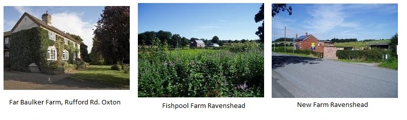
The designated farms contained in the 2008 Sherwood Forest- Explorer Map has been divided into four quadrants.
Intention.
Ideally, should current occupants of each farm wish to add any details, we would like to ascertain as much information as they are willing to divulge, particularly the following points:
1. How long have they had the farm?
2. What type of farm is it- whether it be arable, livestock or other.
3. Acreage.
4. What changes have there been in farming practices during their occupancy of the farm.
We would appreciate any feedback from this article, whether it be to point out errors or to add information that may help us to draw a picture of farming in the Blidworth area. Any photographs of the farms that we could loan, scan and return would be appreciated.
Eric and Sheila Hall - May 2011